 |
|
De Nordlige Bjergmassiver
|
| |
1. DAY
Transfer from Airport
Sightseeing Area during transfer to our Hotel
2. DAY
We will start Hiking the MASSIF of KOMOVI
As a whole this range is a considerable challenge for mountaineers. That's because, besides climbs to its peaks, there is a circular detour the entire Komovi range. And interestingly also, following the contour to the altitude of approximately 1700 m the circulating distance is approximately 18 km...
Kom Vasojevićki (2460m)
Lenght: 13km
Portal: Štavna (1810m)
Target: The peak of Kom Vasojevićki (2460m)
Difficulty: Easy
Time: 4h. (Ascending 2 ½ h. - Descending 1 ½ h.)
Altitudinal difference: 650m
O/N HOTEL 3*
3. DAY Kom Kučki (2487m)
Lenght: 17km
Portal: Štavna (1810m)
Target: The peak of Kom Kučki (2487m)
Midpoint: Međukomlje (1860m), Međukomlje Pass (2171m)
Difficulty: Extreme
Time:6 ½ h. (Ascending 4h. - Descending 2 ½ h.)
Altitudinal difference: 677m
O/N HOTEL 3*
4. DAY Crna Glava Peak (2139m)
Lenght: 20km
Portal: Jezerine (1444m)
Target: Crna Glava peak (2139m)
Midpoints: Katun Vranjak, Zekova Glava peak (2117m), Pešića Lake (1838m)
Difficulty: Difficult
Time: 7h. (Ascending 4,5h. - Descending 2,5h.)
Altitudinal difference: 780m
O/N IN HOTEL 4*
5. DAY Kjuč peak (1973m)
Lenght: 16km
Portal: Paljevine (1360m)
Target: Ključ peak (1973m)
Midpoints: Katun Rupe (1650m), Krivi Do (1685m), Raskrsnica (1725m), Katun Vranjak (1671m)
Difficulty: Easy
Time: 5h
Altitudinal difference: 613m
O/N IN HOTEL 4*
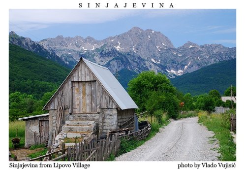
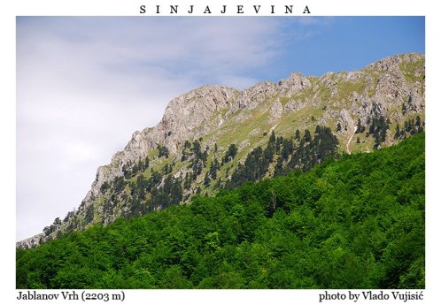
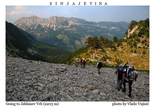
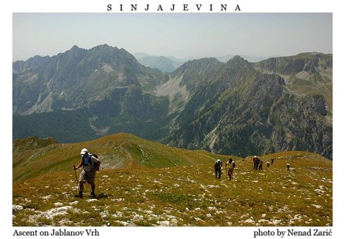
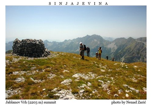
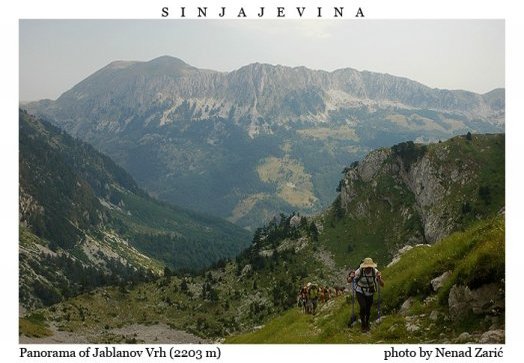
6. DAY Jablanov vrh (2203m)
Lenght:17km
Portal: The village of Gornje Lipovo (1208m)
Target: Jablanov Peak (2203m)
Midpoints: Vratlo pass (1730m), Katun Pilać (1872m)
Difficulty: Easy
Time: 5h 30min. (Ascending 3h 30 min. - Descending 2h)
Altitudinal difference: 995 m
O/N IN HOTEL 4*
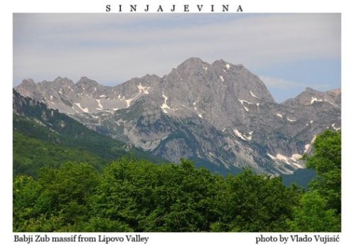
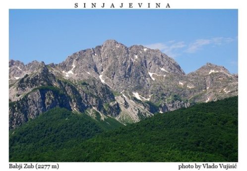
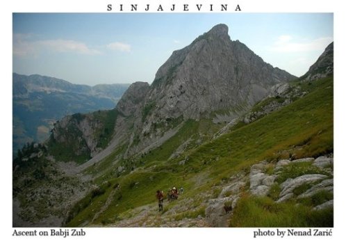
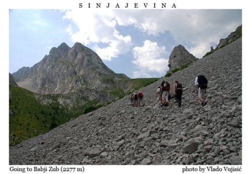
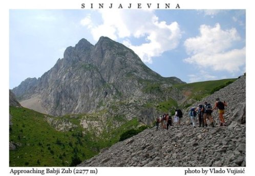
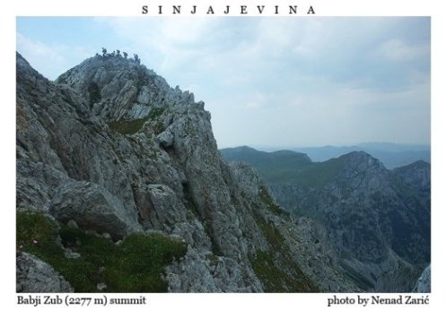
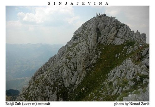
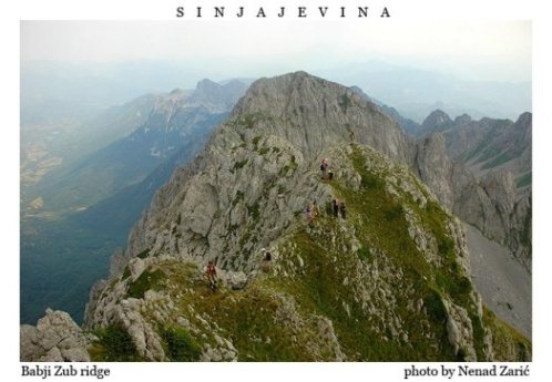
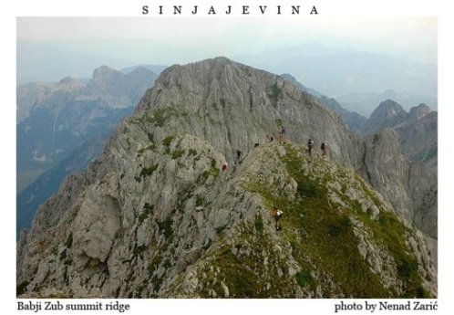
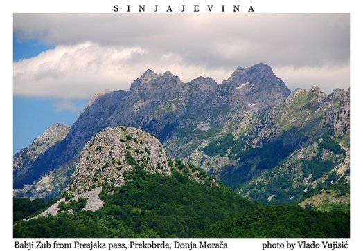
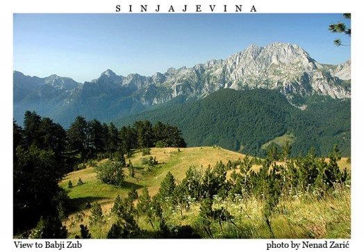
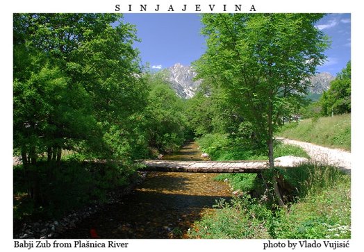
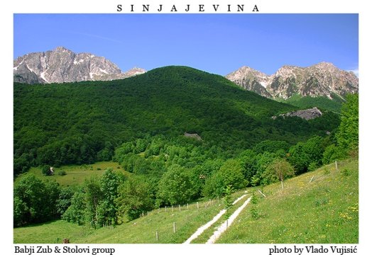
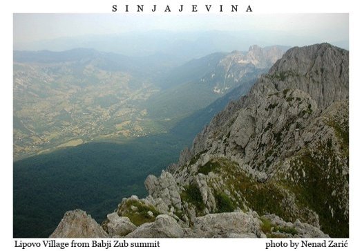
7. DAY Bablji zub (2277m)
Lenght: 19km
Portal: The village Gornje Lipovo (Klisura 1189m)
Target: Bablji Zub peak (2277m)
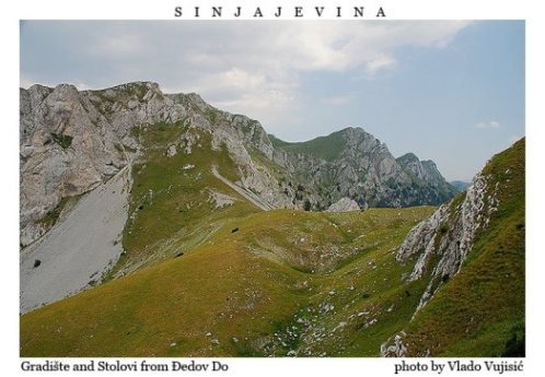
Midpoints: Katunina (1418m), Đedov Do pass (1.943 m)
Difficulty: Extreme
Time: 7h. (Ascending 4h. - Descending 3h.)
Altitudinal difference: 1088m
O/N IN HOTEL 4*
8. DAY
Transfer to Airport
Sightseeing during the transfer to Airport
from 1.283,50 € p.p. (minimum 24 pax pr.group)
Incl. In the price:
2 O/N in accommodation 3* & 5 O/N in accommodation 4* based on HB,
Lunch packed or/and lunch at the locals, according to the itinerary
Coaching in A/C vehicles
Guide ENG speaking present all the time
Possibilities to make a alternative arrangement, all after the budget, groups quantity and group PAX.
Pls. contact us by E-mail: info@montenegrovoyage.com
Together with Durmitor massif, Prokletije massif and Dinaric Alps, Komovi massif belong to the group of most impressive and most magnificent mountain massifs of Montenegro. Komovi massif is situated in the eastern part of Montenegro, and it stretches between the farthest upstream parts of River LIM to the east, and River Tara on the west, to Drcka river to the north and Prokletije massif with Planica mont. to the south.
From the S' and E' it is encircled with a complex of Prokletije mountain massif, also the cross-border between Montenegro and Albania, with its highest peaks at altitude of 2534m Kolac and Jezerski Vrh 2694m,
On the north is Bjelasica mountain with its highest peak at altitude of 2139m - Crna Glava / Black Head.
This mountain massif Komovi, 40 km long and 30 km wide, is encrusted from all sides by spatial plateaus at average altitude of 1900 m
Stavna and Ljuban to the north, Rogam to the west, Crne to the south and Varda to the east.
Than we will move more N'W' to BJELASICA MONT.
Bjelasica is located in the heart of Montenegro in the central continental part, so it branches evenly in four directions and has the shape of a circle. Its length and width is 30 km, and its area is about 630 km².
Its borders are two big rivers, Lim and Tara, and from the north Ljuboviđa and Lepenica. It belongs to the municipalities of Kolašin, Mojkovac, Bijelo Polje, Berane and Andrijevica.
Mountain Bjelasica is characterized by three specificities and important comparative advantages: very easy walking and accessibility to the highest mountain peaks, a large wealth of forest stock and wealth of flowing water. The mountain has an extremely good potential for ski fields.
Unlike other mountains in the region, Bjelasica is of volcanic origin. Hence, green summers and white winters. And while on Durmitor or Lovćen the waters fall, here everything remains on the surface, flowing into numerous streams and rivers, of which perhaps the most important and most beautiful is Biogradska Rijeka, which flows into the pearl of this mountain, Lake Biogradsko jezero.
The highest peak of Bjelasica is Crna Glava, 2,139 meters high.
The no less picturesque mountain ranges of Kom mountain abut the southern slopes of the Bjelasica mountain.
Since 1990, there has been a ski center of the same name in Bjelasica, with 15 kilometers of groomed trails.
The Monastery of St. Cyril and Methodius is located here.
Mountain Bjelasica is certainly one of the most beautiful mountains in Montenegro. Bjelasica belongs to the central continental Montenegrin region, located between the Lim, Ravna Rijeka, Tara and Drčka rivers, and is separated from Kom by the Trešnjevik pass. Bjelasica is bordered on the east by Morački mountains /2226 meters, Sinjajevina /2203 meters, Vojnik /1997 meters/, Golija /1942 meters/, Maganik /2318 meters/, on the north by Prokletija /2694 meters/, Komovi /2487 meters/, Kučka Krajina /2184 meters/, to the west by Mount Hajlo /2403 meters/, to the northwest by Mokro Planin /2003 meters/, to the southeast by Durmitor /2523 meters/, Maglić /2388 meters/, Bioč /2397 meters/, Volujka /2336 meters/ and Ljubusnja /2238 meters/, from the south by the mountains of Serbia Zlatar /1626 meters/ and Zlatibor /1496 meters/, from the southwest by the mountains in Serbia, Kopaonik /2017 meters/, Golija /1833 meters/, Radočel /1643 meters/, Pešter /1617 meters /, Čemernom /1579 meters/. The massif of the Bjelasica mountain, 30 km long and wide, has 10 peaks over 2000 meters. The geological features of Bjelasica are of volcanic origin, with slightly rounded shapes and the wide expanse of its gently undulating landscapes, which are enchanting. The Montenegrin transfer station 1 passes through Bjelasica and enables unforgettable hiking and mountaineering - hiking trail 1 Mojkovac (812 m) - Brskovo (1,433 m) - Bjelogrivac (1,970 m) - Veliko Šiško jezero (1,660 m) - Veliko Ursulovacko jezero (1,902 m) - Crna Glava peak (2,139 m).
Bjelasica consists of four ridges of the Dinaric extension direction that extend in the direction northwest - southeast.
1. The first ridge: Mare's head - Miljevaca - Bull's head - Ključ.
This ridge overlooks the Tara valley (the entire upper course), Kolašin, Sinjajevina, Moračka mountains, Komovo and Ostrvica. Nordic skiing competitions were previously held on this ridge. There is a ridge on both sides, although it is known that Bjelasica is quite flat and rounded. The highest peak on this ridge is Ključ (1972 m.a.s.l.).
2. Second ridge: Donji Lumer - Gornj Lumer - Goleš - Lisa - Troglava - Zakova glava. The reef stretches between the Biogradska river and the Mušovići river. It is slightly lower in height than the previous one, but several high peaks rise on it, the most important of which are Troglava (2075 m.a.s.l.) and Zekova glava (2117 m.a.s.l.).
3. The third ridge: Laništa - Razvršje - Svatovsko groblje - Crna lokva - Crna glava.
The ridge is located between the Bjelojević River in the north and the Biogradska River in the south, and on it is the highest peak of Bjelasica, Crna Glava (2139 m.a.s.l.). The central part is called Šiška planina. Part of this mountain ridge, above the Biograd Lake, is known as the Capricorn side due to its exceptional steepness.
4. The fourth ridge: Mučnica – Marinkovac – Bjelogrivac – Strmenica. The northernmost mountain ridge is located between Ravna Rijeka and Bjelojevići Rijeka with the highest peak Strmenice (2122 m.a.s.l.)
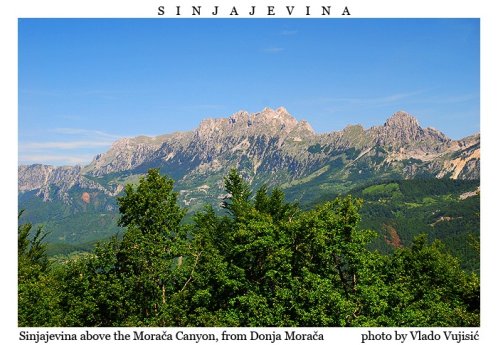
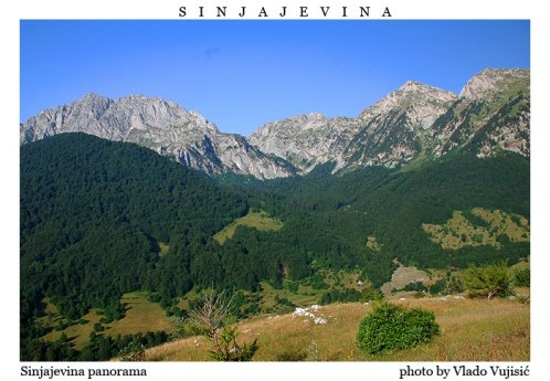
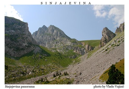
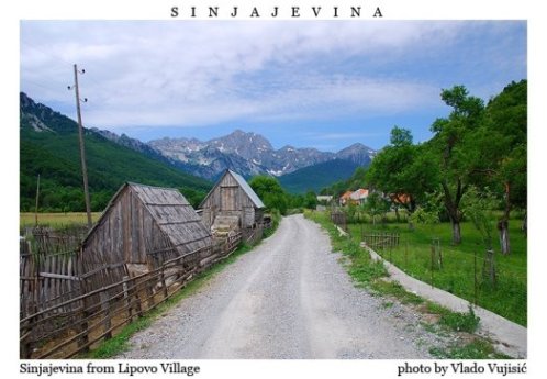
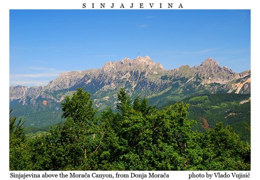
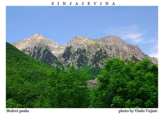
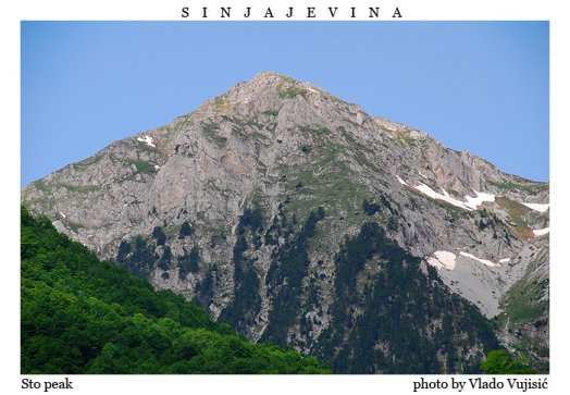
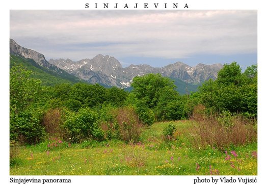
Than we will move even more to W' to reach the MASSIF OF SINJAJEVINA
Near the Durmitor National Park is the mountain peak of Sinjajevina.
This is an unforgettable and incredible place in Montenegro for true lovers of nature and mountain tourism. From the top of the Sinjajevina mountain massif, there is a wonderful panoramic view of the mountains and valleys, as well as of the town of Mojkovac. The medieval town got its name because of the mint, which was there in the 14th century.
The Sinjajevina mountain massif stretches for 40 kilometers from the southeast to the northwest between Žabljak and Kolašin. In addition, near the mountain are the famous Durmitor and Biogradska gora National Parks, the Đurđevića Tara Bridge and the Tara River with its world-famous canyon (the deepest in Europe and the second deepest in the world, after the Grand Canyon of Colorado).
For tourists who want to spend their vacation in the central part of Montenegro, local companies organize hiking along comfortable mountain routes, bicycle tours, horseback riding and other entertainment. In addition, you can also try rafting with Tara.
In addition, Mount Sinjajevina is an excellent place for sports - once the popular competition in Montenegro "Sinjajevinski Sector" was held here. Now there is great progress - the construction of sports and tourist infrastructure is underway, and slowly the mountain can be compared to Bjelasica at the level of ski tourism. The mountain has very interesting, fascinating and comfortable snowmobile trails.
Montenegrin Ranch is located at 1100 m above sea level on a mountain in the northern part of Montenegro. An unusual place was chosen for this type of facility, because mostly such settlements are located on the plains. This ranch is known to many tourists who like a healthy vacation. Beautiful nature, fresh mountain air, hospitable hosts - all this is a guarantee of a good vacation. A modern man should visit these places in order to connect with nature and regain his mental and physical strength.
Mount Sinjajevina - one of the most popular destinations among mountaineers, skiers, and mountain bikers. The best time for summer hiking is from June to September. In winter, the mountain is covered with a thick layer of snow and ice, so crampons and an ice ax are mandatory equipment. Specially equipped tourist camps are not provided, but there are no restrictions to place. In addition, you can spend the night in one of the huts, of which there are many in this area.
There are two lakes for fishing enthusiasts: Zminičko and Zabojsko. The depth of the first is 4 meters, the second - 19. The water of icy origin is clean and surrounded by pine forest. The lakes are protected by the state, and you have to buy a license to fish for trout.
|
|
|
|
HIKING in Montenegro
|
Topic - Sale
Advertisement:
Montenegro Travel
Visit Montenegro
eRegulations
eGovernment
Podgorica
Podgorica Travel
Visas and Visa Regime
|
 |